| Entrance to San
Francisco
Bay
...1 of 4 > |
| June 27, 2017 -
Entering San
Francisco Bay from the Pacific Ocean,
ships sail between Marin County (Pt. Bonita and Pt. Diablo) to the
North and Land's End to the South then under the Golden Gate
Bridge.
The strait under the bridge is 1 mile or 1.6 km wide. The Bay
reaches
its deepest point in the area of the bridge, about 360 feet, and there
are strong tidal currents. The bridge itself has a vertical
clearance
of 225 feet at the center and 211 and 213 feet at the piers. |
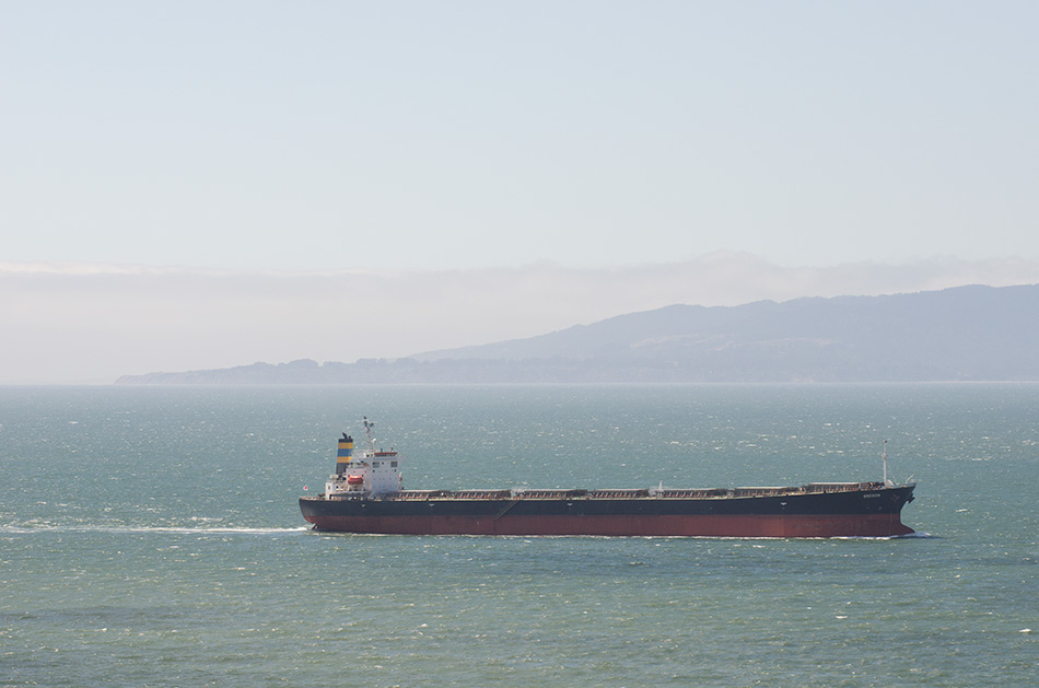 |
| The Oregon arriving, seen from Land's End looking toward Pt. Bonita. Specifications: Bulk carrier—225 m x 32.26 m, gross tonnage 38,727, built in 2002. Flag Malta, home port Valletta. Bound for Pittsburg, Calif., most recently in Abbot Point, Australia. |
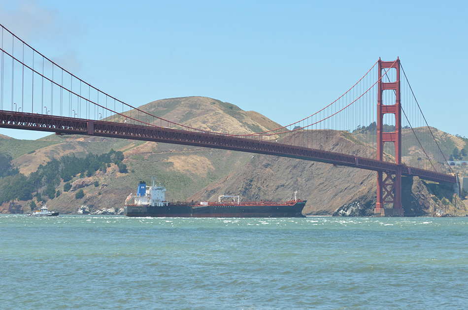 |
| The Overseas Martinez arriving, seen from the Warming Hut at the West end of Crissy Field. Specifications: chemical/oil products tanker—183.2 m x 32.2 m, gross tonnage 29,242, built in 2010. Flag U.S.A.. Bound for Martinez, Calif.. |
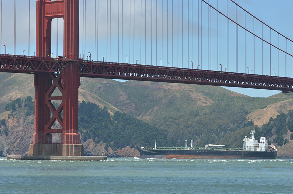 |
| The California Voyager, sailing out of
the Bay, seen from the Warming Hut. Specifications: tanker—188.9m
× 32.2 m, gross tonnage 30,770, built in 1999. Flag
U.S.A.. Bound from Point San Pablo (Richmond) to Panama City
(Balboa),
Panama. San Francisco Bay is the largest estuary on the West Coast and encompasses the Port of Oakland (the fifth busiest container port in the U.S.), the Port of San Fransico (which handled 82 passenger ship calls and 26 cargo vessel calls in 2016) as well as ports in Redwood City, Richmond, the Carquinez Strait and Suisun Bay and all the way to Stockton and Sacramento. |
Copyright © 2017 Eric M. Appleman
All rights reserved.